Mullet Bay: Court confirms that the beach Is public and the land behind it is private
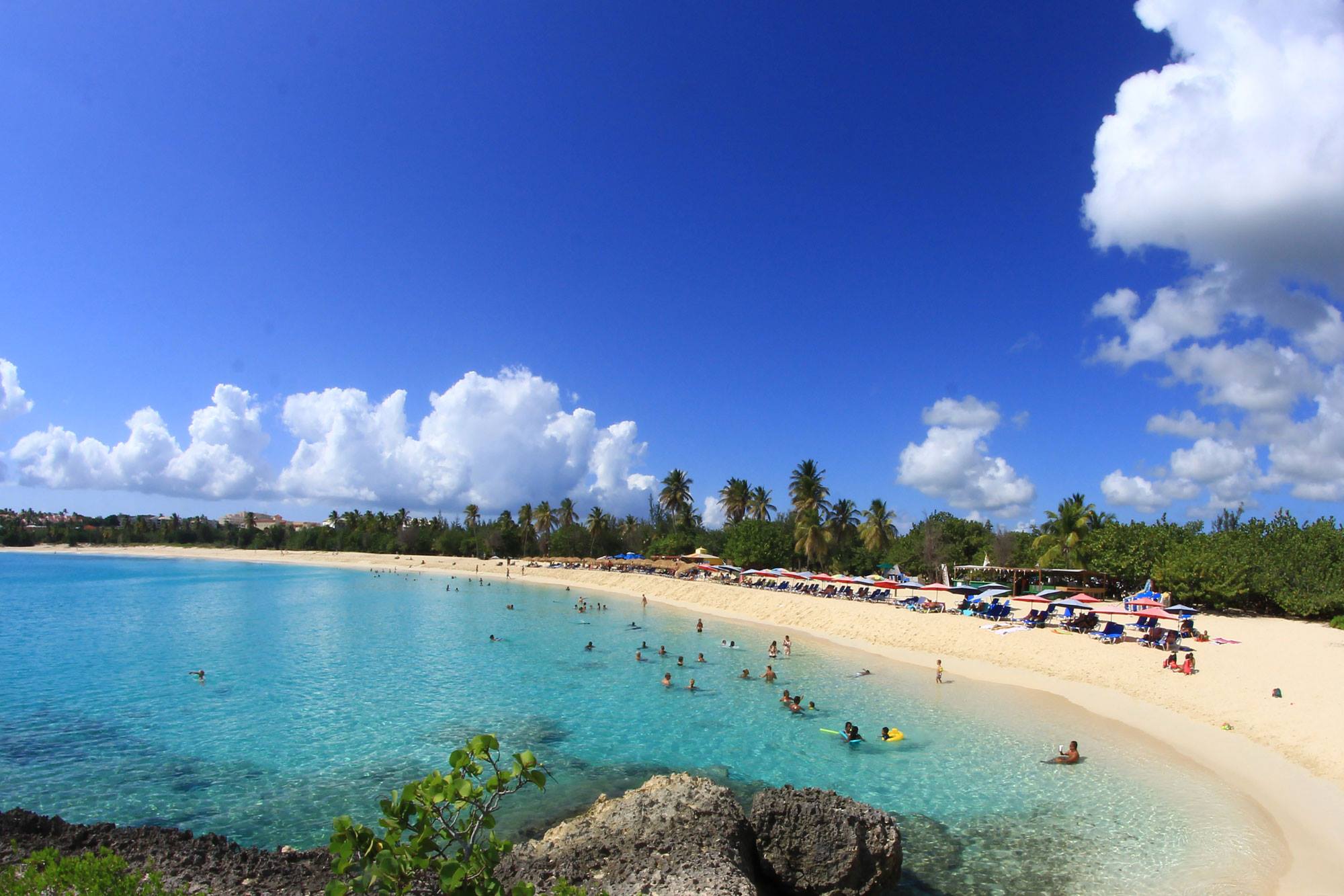
The St. Maarten Court of First Instance recently heard a complex case concerning ownership of Mullet Bay Beach and the land behind it. Sun Resorts, the company that operates the golf course (and, prior to 1995, the hotel destroyed by Hurricane Luis), claims to be the owner and accuses the government of leasing part of its land and granting building permits on it.
It has filed several motions seeking a court ruling to confirm its ownership of the beach and the surrounding land, to prohibit the government from leasing its parcels under penalty of a $10 million fine, and to order the government to notify in writing the parties to whom it has leased the land that it did so without being the owner, under penalty of a $1 million fine for each day of delay.
The case required tracing the history of Mullet Bay back to the mid-19th century.
It all began in 1852
In October 1852, James Alexander Farguerson Peterson sold a parcel of land* to Emile Beauperthuy. Emile Beauperthuy’s nephew, “Charles Daniel Beauperthuy, took possession of the land and considered himself its owner,” the court explained.
Upon Charles Daniel Beauperthuy’s death, his heirs transferred a large parcel of land to the Colony of Curaçao in 1943, and then another one in early November 1957 to X**.
X sold this parcel in two separate transactions—in 1957*** and 1966—to Island Gem Enterprises LTD, which became Sun Resorts in 1985.
The Question
These transfers are not in question. The difficulty lies in determining whether the beach—which is of great economic importance—was part of the initial transaction in 1852, and therefore of those in 1957 as well.
The notarial deeds from that time contain only a simple physical description of the parcels. In 1852, the parcel extended “to the beach”; in the deed dated November 6, 1957, it was “bounded on the south by the shoreline”; and in the deed to Sun Resorts dated November 16, 1957, it was “bounded on the west by Mullet Pond Bay and the Caribbean Sea.”
Based on these notarized documents, Sun Resorts thus claimed to be “the owner of the parcel of land up to the normal high-water line (of the sea).” It later corrected this during the proceedings to read: “up to the boundary with the adjacent beach.”
On the other hand, the government has always maintained that the beach is public. The court confirmed that, under Dutch and Roman law until 1869, beaches were public and remained so with the entry into force of the Civil Code in 1869 and again in 2001. It also relied on the words of a 17th-century Dutch jurist, who stated that “the bare beach belongs to the inhabitants of the Earth.”
The Ruling
“A private individual cannot develop a natural beach. It is not clear that the situation is any different in Sint Maarten. This means that James Alexander Farguerson Peterson could not have transferred the current Mullet Bay beach to Emile Beauperthuy in 1852,” the court concluded.
“Nothing was alleged in these proceedings regarding the use of the sandy beach located between the shoreline and the high-water mark prior to 1957. It is established that Sun Resorts has been operating the surrounding land since 1957, but not the beach itself. All of this confirms the assumption that the beach remained ‘in the public domain’ during that entire time. This is also consistent with the fact that Sun Resorts itself, when filing its initial application, acknowledged that it did not own the beach. It was only in the context of these proceedings that it adopted this position,” the court continued.

Furthermore, the court recognized that the land behind the beach belongs to Sun Resorts. Therefore, the government had no right to lease it. The company provided the leases and permits granted by the government to third parties for this land, including the construction of a restaurant.
“Sun Resorts submitted a site survey. It is clear that the vegetation behind the current beach consists of trees and shrubs. Sun Resorts demonstrated that this is natural vegetation that has been there for a long time. (...) Sun Resorts has also demonstrated that, among other things, trees and shrubs were removed from the current site of Restaurant Y. Consequently, the restaurant is not located on the beach,” the court agreed.
“Even if the beach does not belong to Sun Resorts, the government naturally cannot grant a building permit on the adjacent parcel owned by Sun Resorts or lease property located there to third parties without Sun Resorts’ authorization,” the court concurred, acknowledging that “the government is acting unlawfully toward Sun Resorts.”
It thus prohibited the government “from acting as the owner of the parcel and from granting the use of and/or leasing to third parties any parcels of land belonging to Sun Resorts, under penalty of a fine of 1,000,000 USD for each violation of this prohibition.” It also ordered the government to notify the individuals to whom it has leased or granted a permit that it is not authorized to do so.
* The parcel sold by James Alexander Farguerson Peterson to Emile Beauperthuy: “The western portion of the lands known as Mullet Pond, located in the district of Simpson Bay, in the Dutch part of this colony, extending from a line running nearly southeast between the two water sources and one hundred paces from the eastern end of said pond, so that the spring becomes the property of the purchaser of the aforementioned western portion of the aforementioned lands, known as Mullet Pond, along with all the lands included within the aforementioned perimeter, including the pond pertaining thereto and the dock or entrance to said pond, as well as a small pond at the end of Mullet Pond, along with the lands within the perimeter, also sold together with the large savanna or grassy plain extending to the boundaries of the lands known as Cupy Coy, bordering the aforementioned lands to the north by Simpson Bay Pond, to the south by the seashore, to the southeast by the aforementioned boundary line, and to the west by the aforementioned lands of Cupy Coy.”
** Plot of land purchased by X from the Beauperthuy heirs: “A plot of land located in the Dutch part of Sint Maarten, bounded as follows: to the north by Simpson Bay Lagoon; to the south by the shoreline; to the west by the lands belonging to Erik Lawaetz; and to the east as follows: starting from the southwest corner of the eastern part of Mullet Pond, which is also the southeast corner of the other lands of Mullet Pond, from triangulation point number eleven, in a northeasterly direction to 100 meters east of Mullet Pond. From there, continuing northwest over the wall between two freshwater springs, until the boundary crosses the shoreline of Simpson Bay Lagoon. The freshwater springs are located in the northwestern part of the peninsula north of Mullet Pond, as of July 10, 1956.”
*** First parcel sold by X to Island Gem Enterprises Ltd. NV: “A parcel of land located in the Dutch part of Sint Maarten, known as ‘Mullet Pond,’ and bounded as follows: to the north by parcels numbered 174, 188, and 141; to the south by parcels numbered 170 and 169; to the east by Mullet Pond; and to the west by Mullet Pond Bay and the Caribbean Sea; each with all rights and easements, benefits and encumbrances, as well as the amenities and revenues attached to the aforementioned real property. The land described above has an area of 18.2 hectares, or approximately 45.7 acres, as attested by a survey certificate issued in Sint Maarten by the government land surveyor on October 15 of this year, under number 42.”