

04.07.2017
The system is expected to encounter a dryer which should be less favorable for development.
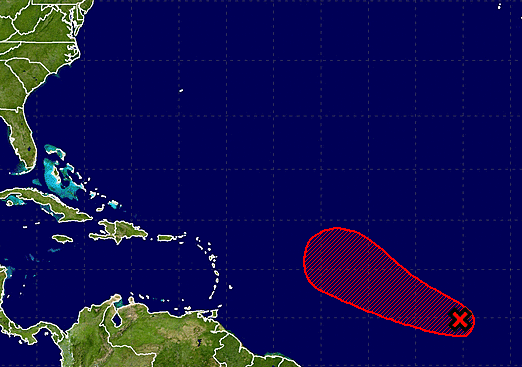
Satellite images indicate that the cloud pattern associated with the
broad area of low pressure centered about 800 miles west-southwest
of the Cabo Verde Islands has changed little in organization since
yesterday. Environmental conditions are still favorable for a
tropical cyclone to form within the next day or two while the low
moves westward or west-northwestward at 10 to 15 mph across the
tropical Atlantic. After that time, the system is expected to
encounter a dryer and more stable air mass, which should be less
favorable for development.
* Formation chance through 48 hours...high...70 percent.
* Formation chance through 5 days...high...80 percent.